Geospatial AI GeoAI

Geospatial AI: A Data-Centric Approach for Growth & Development

Artificial Intelligence , Computer Vision , Deep Learning

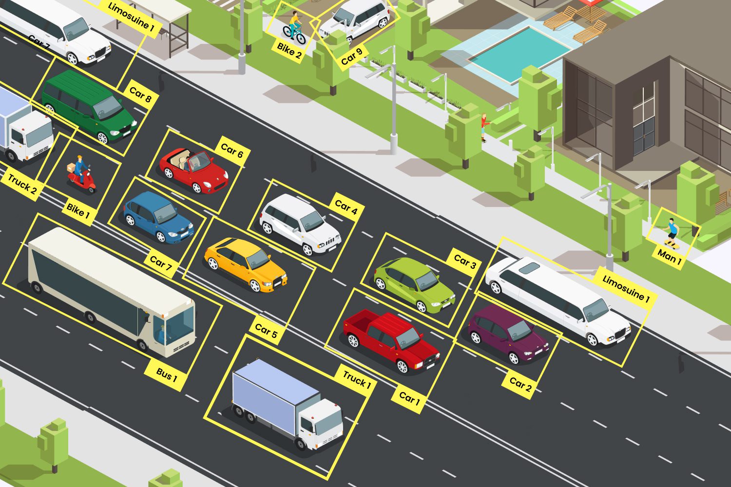
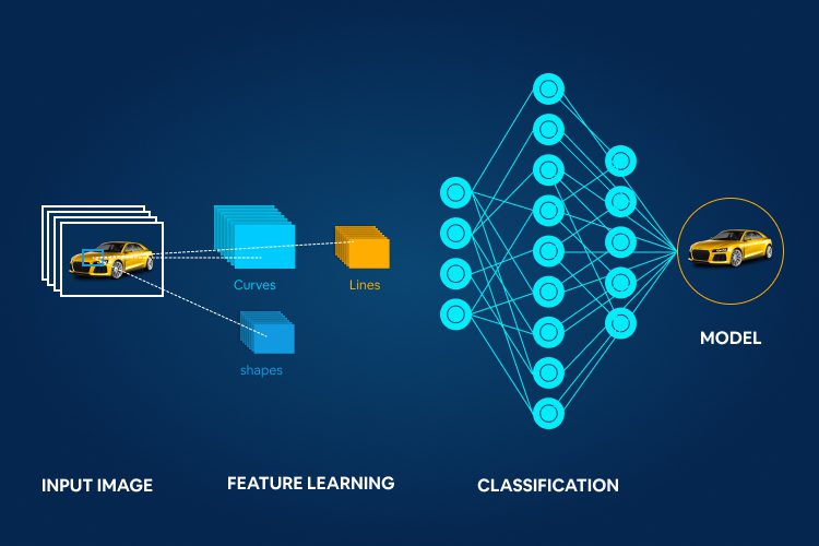
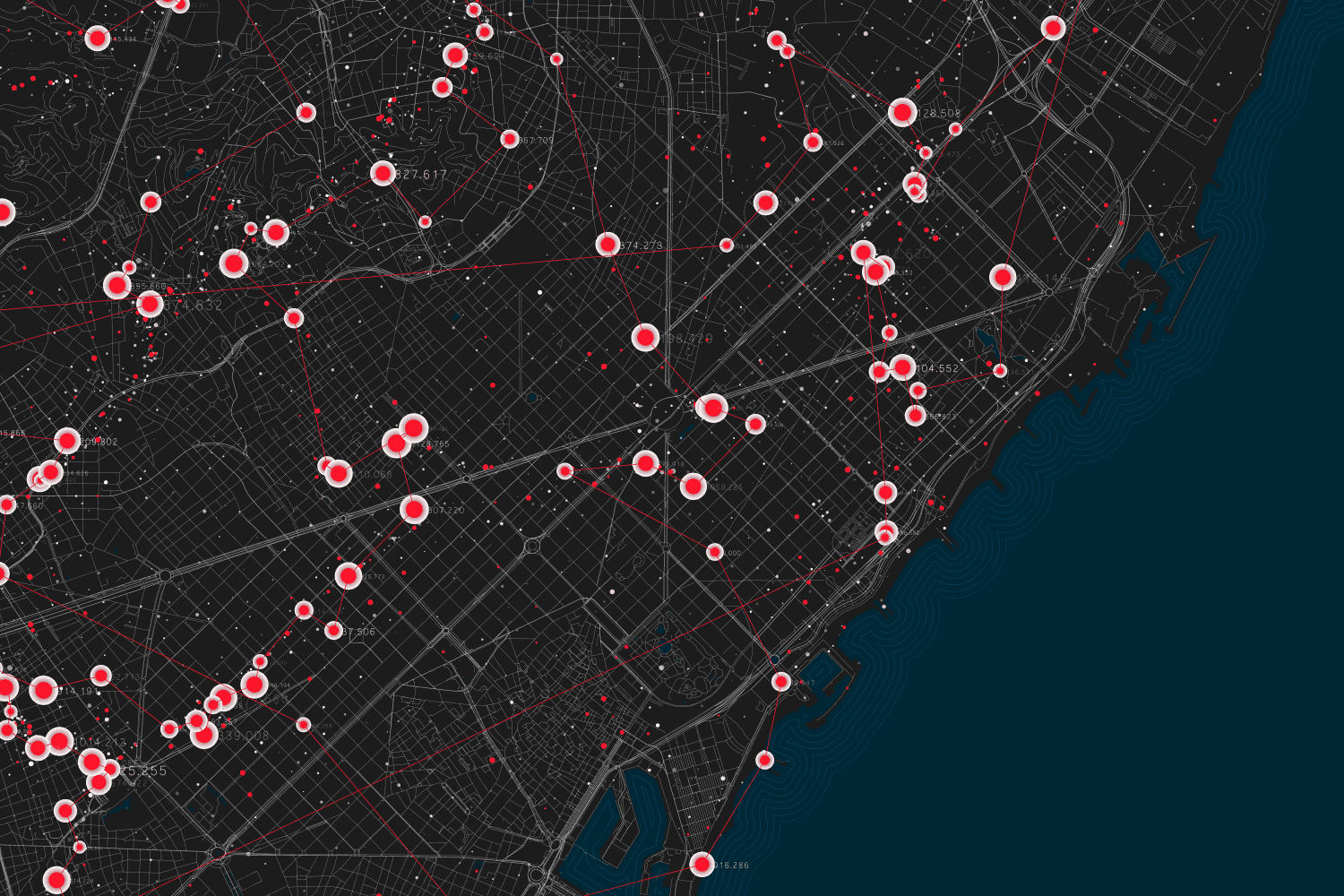
GeospatialAI or GeoAI is an evolving field aiming to help organize, process, and analyze spatial big data with spatial science and AI methods like machine learning, deep learning, data mining, and high-performance computing. The increased availability of geospatial data, advancements in AI, and the availability of massive computing power have resulted in the mounting relevance …

Read more
image annotation

Image Annotation: Guide to Create Training Data for Computer Vision

Artificial Intelligence , Computer Vision , Machine Learning

Image annotation is one of the vital applications of computer vision, which allows the machines a high-level ability to deconstruct digital images or videos and interpret the visual information just like humans. Most of the remarkable applications of AI like self-driving cars, medical imaging, self-flying drones, etc., are only possible through image annotation. While image …

Read more
image classification with deep cnn

Deep CNN for Image Classification: How it Makes a Difference

Computer Vision , Deep Learning

Deep convolutional neural network (CNN) based image classification plays an essential role in seamlessly performing most of the challenges from disease diagnosis to predicting consumerism behavior. Using Deep CNN reduces the time and effort required to spend on extracting and selecting classification features manually. In recent times, deep CNN has been applied to image classification …

Read more